Kansas Death Records
 Kansas Newspapers, Full Search (1841-1981), 317 titles
- Kansas Obituary Search, (1989-current)
- Kansas Birth Records Database, (1841-1981)
 |
| Click photo to enlarge |
 |
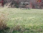
| Click photo to enlarge |
Adams Burial Ground
Johnson County, Kansas
14800 Evening Star Lane, Johnson County, KS
Lat: 38° 51' 28"N, Lon: 95° 02' 19"W
McCamish Twp, Sec 2
Contributed by Linda Lewis, Nov 20, 2006 [webmaster@cottonhills.com]. Total records = 2.
From 169H and Santa Fe in Olathe, take the Santa Fe exit west and continue for approx. 10 miles. Santa Fe turns into 135th St. Turn left on S Spoon Creek Rd and go 1 mile. Turn right on 143rd St and go approx.3 miles. Turn left on Evening Star Rd and go approx. 8 miles. Cemetery is the middle of a field on the west side, across from a home on the east side.
This Shawnee Indian burial ground is set in a scenic location, on the east side of the woods that border Captain Creek. The cemetery is high on a hill that overlooks Plum Creek and the woods to the west, near the old Oregon branch of the Santa Fe Trail. All that remains of this family burial ground is the old wooden fence constructed when the land was farmed to help protect and preserve the area.
This is a complete transcription I did on Nov 04, 2006, by reading and photographing the gravestones. Photos available upon request.
- Linda LewisAdams, John, d. 27 Nov 187?, Date illegible on headstone, Footstone J A
Adams, Joseph, d. 27 Nov 187?, Date illegible on headstone, Footstone Joseph A