Search Death Records (United States)
 U.S. Newspapers, 50 State Full Search (1690-present)
- U.S. Obituary Database Search, (1696-present)
- U.S. Birth Announcements Database, (1700s-present)
Ayer's Cliff Cemetery
Ayer's Cliff, Stanstead County, Quebec
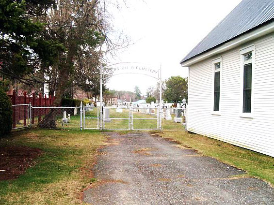 |
Ayer's Cliff Cemetery, Ayer's Cliff, QC |
GPS: 45.170775, -72.041949
967 Rue Main
Ayer's Cliff, QC J0B 1C0
Canada
Contributed by Leslie Nutbrown ![]() May 03, 2005, last updated February 6, 2020
May 03, 2005, last updated February 6, 2020
Total records: 1,138
Driving Directions
Ayer's Cliff is a small town at the south end of Lake Massawippi. Once known as Ayer's Flat, it is only about 15 miles from the Vermont border. Follow Route 143 from Vermont or from Sherbrooke. At Burroughs Falls take Route 141 West a couple of miles into Ayer's Cliff. The cemetery is located right on Main Street in Ayer's Cliff in back of Beulah United Church and right beside the Fairgrounds.
Cemetery History
The cemetery is well laid out, well kept and nearly all stones are readable. Burials range from about 1850 to the present day. It is maintained by the Ayer's Cliff Cemetery Association.
Cemetery Records
Records linked below were transcribed from tombstone inscriptions by Leslie & Susan Nutbrown during a visit to the cemetery in April of 2005, along with periodic updates made since.
Legend: (CR) = church record
Records Index:
Browse More Cemetery Records